Walkability Index
Explore neighborhood walkability at a human scale. Built on the U.S. EPA’s National Walkability Index (NWI).
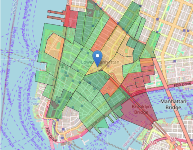
How It Works
Location
Enter an address.
Define the Boundary
Set your evaluation radius.
Results
See aggregated scores and variation.
Compare Two Locations
Evaluate two locations side by side using a shared radius. This keeps the search area consistent so differences reflect neighborhood conditions.
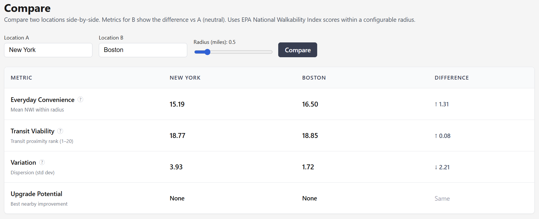
Outcome: decision-makers can compare candidate areas on the same 1-20 NWI basis before making site selection decisions.
System Design
Walkability is averaged across block groups within the selected radius. Larger radii make results steadier, while smaller radii show more local variation.
Architecture
- PostGIS — Table: national_walkability_index
- Radius filtering — Includes only block groups within the selected distance
- Spatial indexing — Speeds up geographic queries before exact distance checks
- Preprocessing — Geometry simplification
What It Enables
- Evaluate at neighborhood scale
- Fair comparisons
- See how radius affects results
- Apply logic across cities
Current Limitations
Known constraints are tracked explicitly so iteration stays fast and assumptions stay visible.
Constraint
Geocoder reliability depends on third-party services
The app uses Nominatim to look up addresses, with the U.S. Census geocoder as a backup. Results can still be inconsistent when either service is unavailable or when an address is incomplete, unusual, or hard to match.
Constraint
Radius edge cases still exist
Very small radii, sparse geographies, and coastal boundaries can return few or no block groups, which is correct behavior but can feel inconsistent to users.
Constraint
Coverage assumptions are based on census block groups
Scores are averaged at the census block-group level, not at the parcel or street-segment level, which can obscure very local conditions.
Constraint
Some views still lack the same capabilities
Explore currently has the most complete map experience, including a color-coded score layer, while Compare still has UX gaps such as partial-result handling and a more efficient single-request comparison flow.
What's Next
The next iteration focuses on clearer comparisons, more reliable search, and richer context for exploring neighborhoods.
Next experiments
- Make side-by-side comparisons faster and simpler, with results that load together in one view.
- Bring the same map overlays and visual cues from Explore into Compare, so differences are easier to spot at a glance.
- Make address lookup more reliable, especially for tricky searches like rural routes or incomplete addresses.
- Add more context beyond walkability alone, including how easy it is to reach nearby destinations.
- Let people filter dashboard insights by location and distance, so the analysis feels more focused and actionable.